Sunday, April 29, 2012


 It is very refreshing to see some of the original landscape of the Calumet Region preserved, especially in the middle of such a highly developed urban area.
 The oxbow.  You can see the wall of I-80/94.

 The swamp grasses are far taller than I am!
 Trails through the grasses.

 Some old beaver activity.  Nothing like the chewed trees we would likely have seen from the ancient giant beavers that inhabited our area long ago though.
 Looks like there must have been a fire here recently.  I wonder if it was a "controlled burn"?  Performing controlled burns is a highly beneficial technique used to maintain healthy habitat.  It is amazing that such a wet, marshy area, could even light on fire!


 Shoreline trails.
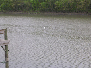
 On the back of the Carlson Oxbow area is the Little Calumet River.  Here's a bird that took off flying when I came over the ridge.
 Look to the opposite shore and you can see a great blue heron.

 The bird that I spooked landed a ways down shore so I got as close as I could and got a picture.
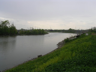
 Facing the opposite direction from the ridge along side the Little Calumet River.
Nice walking path they built across the marshy area surrounding the oxbow.


 Upstream Kankakee River, notice how straight it is.
 Downstream Kankakee River, also very straight.
 Range Line Rd. cuts straight through the woods.
 Each side of the road never really gets completely dry.
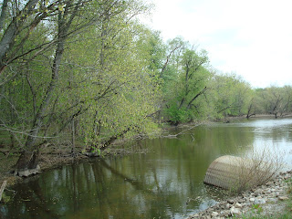
 Again used for river flood control, but simultaneously is an example of how the entire glacial outwash used look.  This is also a nice picture to analyze some of the local flora.
 This photo taken facing north before reaching the Grand Kankakee Marsh County Park shows how flat the outwash plain is, now utilized as farm fields.  The tree line in the distance is the county park.
 Farm ditches keep the crop land drained but also keep water close enough for irrigation.
Many farmers use ditches and pump houses to drain fields and maintain water levels below the banks of these ditches.
This photo shows one of the largest known erratics in our area.  Just off the shore of Lake George in Hobart, Indiana this erratic was left behind by one of the glaciers that previously covered the Calumet Region.
 This photo is of a farm field on the east side of Rangeline Rd south of Rt. 2 and shows how perfectly flat this area in the glacial outwash plain is.
This photo taken just south of Rt 30, in comparison with the previous photo, shows that the terrain becomes much more hilly the further north you get.  This is because at this point you are no longer in the glacial outwash plain, but crossing over the Valparaiso Moraine.
 This shows a little bayou just off the Kankakee River in Shelby, IN.  Little flood areas like this along the river help keep the river from overflowing it's banks in residential areas more often that it otherwise would.
This is a photo facing straight upstream on the Kankakee River at St. Rd. 55.  This photo shows how straight the river is, however this straightness is not natural.  The streamlined, straight nature of the river is a result of the dredging that took place in the early 20th century in order to drain marsh covered nutrient rich soils of the glacial outwash plain so that it could be used for farming.
 There are many sand dunes near the lake but did you know there is also quite a few in the glacial outwash plain.
These two photos show a dune on the south side of Rt. 10. which seems kind of out of place in such a flat area.  However the sandy hilly nature of this dune may be the only reason it has not been leveled and turned into farm fields yet.
 Still inside the LaSalle Fish and Wildlife Area these photos show more representative landscape
of the ancient glacial outwash plain which consisted of mostly marshy/swampy areas.
Average depth of these flooded areas is usually less than 4 feet.  
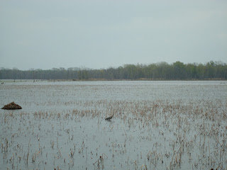
 Here you can see a muskrat house and a great blue heron.  These swampy areas make great habitat
for muskrat, river otter, snakes, many fish species, and migratory birds.
Our areas marshes have been used for hundreds if not thousands of years
as a seasonal resting area for many migratory birds on their yearly N-S travels.
If you zoom in you can see two turtles sunning right next to the water.
 Kankakee River on the west side of Rt. 41.
 Marshy flooded area along the Kankakee River in LaSalle Fish & Wildlife Area 1.
 Marshy flooded area along the Kankakee River in LaSalle Fish & Wildlife Area 1.
On the other side of the access road from the previous photos of flooded swampy area is some hardwoods.
The water level in this area sometime floods over the road and into the woods.
Evidence of this is seen by the water stains that can be see 1-2 feet up the trunks of these trees.